Article
Naver and Kakao Map for Drama Trips
Use Naver Map and Kakao Map on a K-drama trip: search Korean names, save verified stops, and walk the last leg from the subway without guessing.
Last checked: Nov 4, 2026
Map data © OpenStreetMap contributors. Pins show places with a sourced address.
A K-drama filming location is rarely hard to admire and often hard to find. The place itself may be an ordinary lane, a palace wall, or a neighbourhood bridge, and the English name you remember from a fan post may not be the name a Korean map recognises. That gap — between knowing a stop exists and standing in front of it — is where most drama trips lose time. This guide closes it with the two apps Korean travellers actually use: Naver Map and Kakao Map. It makes no new filming claim. Every worked example below is a stop already graded Confirmed or Reported in one of the site’s guides, and the apps are treated as navigation tools, not as sources for whether a scene was filmed somewhere.
Start with the guide, not with the map. The site’s guides give you three things a map search needs: the place name, the neighbourhood, and, where the guide states one, the address or the subway exit. Copy those details into the app rather than typing a drama title and hoping the results understand you. Searching for a drama name alone will surface fan pins, cafés, and tour products that may have nothing to do with the verified stop. Searching for the place name, in Korean where the guide gives it, plus the neighbourhood, is the difference between a useful result and a plausible-looking wrong one.
Before you leave: set the apps up once
Install both apps before the trip, not at the station. Having both matters because coverage is not identical: one app may show a walking route or a bus stop the other renders differently, and on a day when one app’s transit data looks thin, the other is your second opinion. Sign in if you want saved places to survive across devices, and check that each app’s language setting is showing English where you need it. Both apps offer English interfaces, but Korean place names, street signs, and some business details still appear in Korean, so do not assume that switching the language switches every label. Keep the guide open alongside the app for the first few searches until you trust how each app spells the stop you want.
Save stops the night before, in walking order, not in the order the guide lists them. A guide lists stops for verification, not always for walking, and a saved list in the wrong order will send you back and forth across a neighbourhood. The Goblin Seoul walk in this site’s guide, for example, is easiest as an Anguk morning followed by a City Hall afternoon and a separate Line 2 hop, rather than as a single straight line. The Lovely Runner Suwon walk runs downhill from a pavilion to a watergate, through mural alleys, and finishes on a café street. Save them in that walking order, give each saved pin the guide’s name rather than a nickname you invent, and you will spend the day walking forward instead of re-sorting the list on the street.
Searching: use the Korean name, the neighbourhood, and the address together
The single most useful habit is to search with all three pieces at once. Take Gamgodang-gil, a Confirmed stop on the Goblin in Seoul guide: the guide gives it as a lane in Jongno-gu, at Yulgok-ro 3-gil 4, reached from Anguk Station on Line 3. Typing only a translated phrase such as “stone-wall road” can land you on a different lane, and the guide itself warns against confusing Gamgodang-gil with Samcheong-dong’s stone-wall road. Typing the lane name together with the address, or the Korean road name where the guide provides it, narrows the result to one place instead of a cluster of similar-sounding ones.
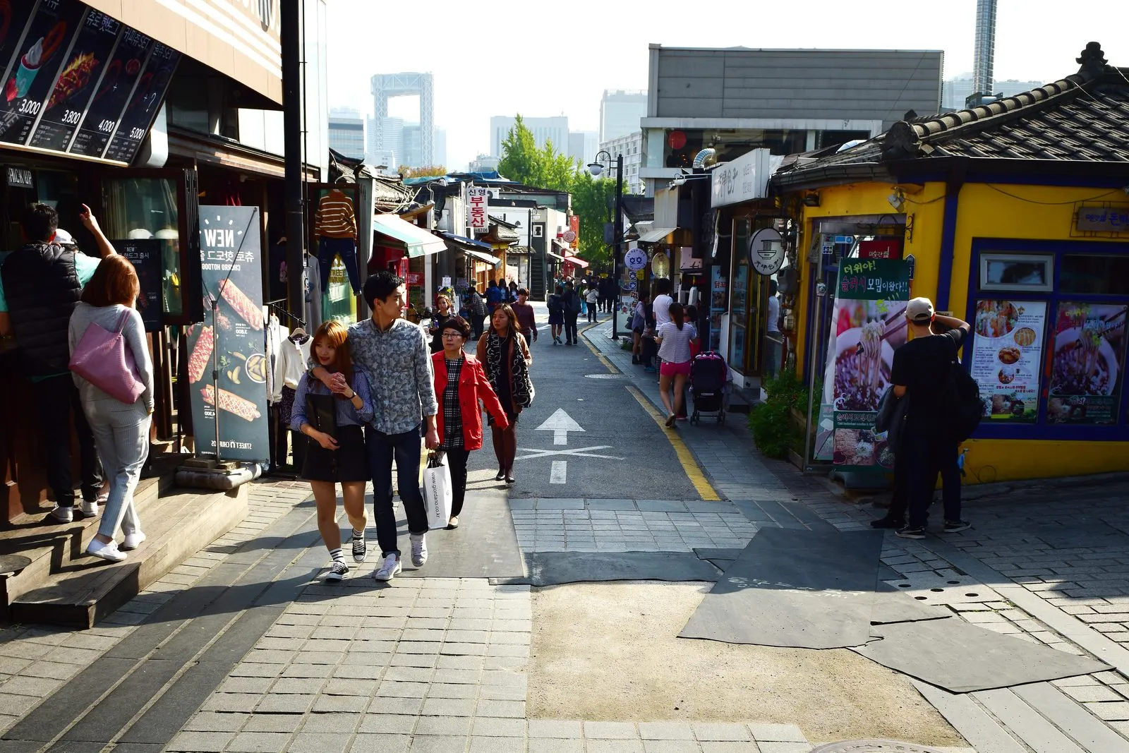
출처: 한국관광공사, 공공누리 제1유형 (photo via the Goblin in Seoul guide).
The same habit protects you at the second Goblin stop, Unhyeongung Yanggwan, the European-style mansion beside Unhyeongung palace at 464 Samil-daero. The mansion is exterior only, on a university campus, and the guide is explicit that casual entry is not supported. A map search that returns the palace grounds is not a failure: the grounds are the public place you can walk, and the mansion is viewed from outside the palace wall. If your search result shows only a campus building with no public entrance, that is the app telling you what the guide already told you — do not treat a pin as permission to enter somewhere.
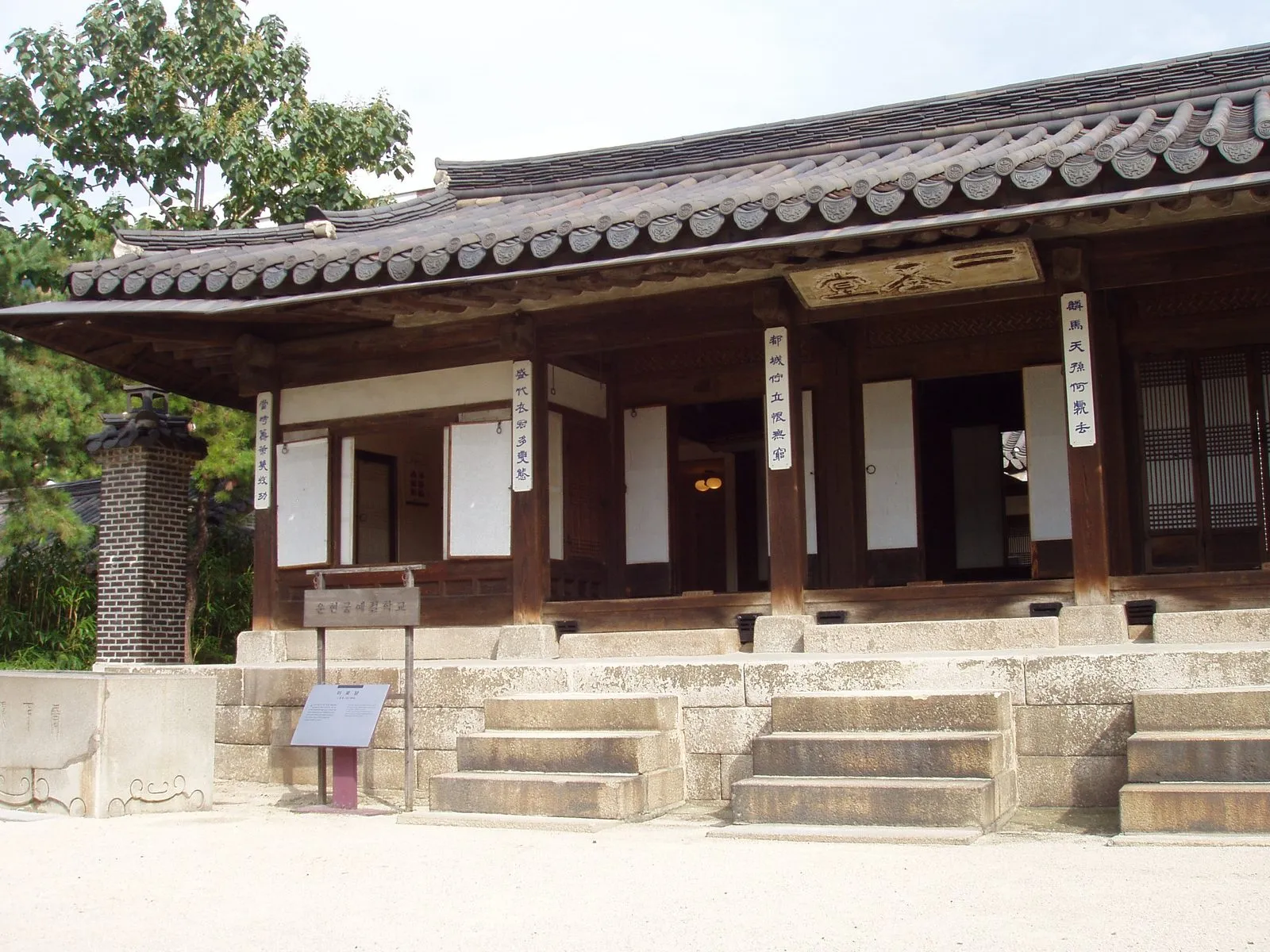
Photo: Daderot / Wikimedia Commons, CC BY-SA 3.0 (photo via the Goblin in Seoul guide).
For a Reported stop, the search habit matters even more, because the label itself is a warning. The Deoksugung stone-wall path on the same Goblin guide is Reported, not Confirmed: one tourism itinerary lists it, and no second qualifying source has confirmed the drama link, so the guide names no specific scenes for it. When you search for it, you are navigating to a real, public walk — VisitKorea lists it at 24 Sejong-daero 19-gil, Jung-gu, open all hours — not to a confirmed scene location. Keep the two ideas separate in your saved list: label the pin “Reported” as the guide does, and enjoy the walk on its own merits rather than hunting for a scene the sources do not pin down.

출처: 서울특별시 중구, 공공누리 제1유형 (photo via the Goblin in Seoul guide).
In Suwon, the same method works at a neighbourhood scale. The Lovely Runner in Suwon guide covers four Confirmed stops in one compact quarter: Banghwasuryujeong Pavilion above Yongyeon Pond, Hwahongmun Gate on the stream, the Haenggung-dong mural alleys, and Haengnidan Street. Searching for “Suwon” alone will not get you to any of them. Searching for each stop name together with Haenggung-dong, and saving the four pins in downhill order, gives you a loop of about 790 metres on site, according to VisitKorea’s course distance cited in the guide. The guide also notes that the last leg from Suwon Station to Haenggung-dong is a map-app job, with no bus number or exit stated in the cited pages — which is exactly the kind of leg you should solve in the app on the day, rather than trusting a number printed in an article.
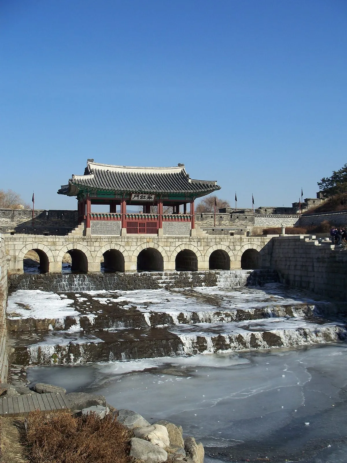
Photo: Seongryong Hong / Wikimedia Commons, CC BY 3.0 (photo via the Lovely Runner in Suwon guide).
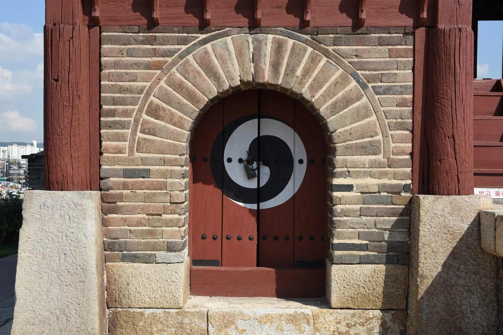
출처: 국가유산청, 공공누리 제1유형 (photo via the Lovely Runner in Suwon guide).
Getting there: let the app choose transit, but check the exit yourself
Both apps give subway, bus, and walking routes, and for drama trips the walking route is often the most honest one. A stop that looks close on a city map may involve an uphill lane, a palace wall, or a residential alley that a driving route would skip. Ask for the walking route from the station exit the guide names, not from the station in general. The Goblin guide, for instance, puts Gamgodang-gil about a three-minute walk from Anguk Station Exit 1, and Unhyeongung about 100 metres from Anguk Exit 4. Those exit numbers are the detail that turns a station into a starting point. If the app’s suggested exit differs from the guide’s, follow the guide’s exit first and re-route from there; the app will recalculate, and you will still be walking from the right side of the station.
For the last leg, use the map’s street-level view to confirm the final turn rather than the pin alone. Pins sit on buildings, gates, and stretches of wall, and a pin placed on a palace complex does not tell you which gate to enter by. Zoom in, check which side of the road the pin sits on, and compare the surrounding street names with the guide’s address. At Yongdap Station on Line 2, the Goblin guide’s pedestrian bridge is right at the station, at 159 Salgoji-gil, so the check is quick; at a fortress watergate or a mural alley, the check is the whole visit, because the stop is a stretch of wall or a network of lanes rather than a single doorway. In residential alleys, the rule from the guides applies to the map as well: keep to public streets, stay out of private yards and doorways, and do not follow a pin onto someone’s doorstep. The mural village in Suwon and the house exteriors on Haengnidan Street are lived-in places first and filming locations second, and a map pin does not change that.
On the day: three checks before you trust any route
First, check hours and closures in the app and in the guide on the morning you travel. The Goblin guide lists Unhyeongung’s palace grounds as closed on Mondays, with a time-limited evening opening on selected days, and the Bukchon-area Red Zone restricts tourist access to daytime hours. An app route will not warn you about either. Second, check fares and timetables on the official operator pages on the day, not in a saved screenshot: fares change, and this article deliberately quotes none. For intercity legs, check the official Korail site on the travel day, as the site’s standing direction requires, rather than relying on any timetable link printed elsewhere. Third, re-check the saved pin before you set out. Businesses move, palace programmes change, and a pin saved months ago can point at a renamed café. If the app’s current name and the guide’s name no longer match, trust the guide’s address and neighbourhood over a new business name, and re-search from those.
A final habit saves the most time of all: when a search fails, shorten it in the right direction. Drop the drama title first, then the English description, and keep the Korean place name and the neighbourhood. If that still fails, search the nearest station or landmark the guide names and walk from there using the guide’s exit and distance. The goal is never to prove the app wrong; it is to arrive at the verified stop by the most reliable anchor the guide gives you, whether that anchor is an address, a station exit, or a palace gate.
Practical notes
Neither app replaces the guide, and neither app verifies a filming claim. Use them for what they are good at — finding an address, choosing a walking route, and confirming a station exit — and use the guides for what they are good at: telling you which stops are Confirmed, which are Reported, and which scene details the sources actually support. Save stops in walking order the night before, search with the Korean name plus neighbourhood plus address, check the exit yourself, and solve the last leg in the app on the day. That routine will not make a drama trip shorter, but it will make it honest: every pin you walk to will be a place the sources name, reached by a route you chose, rather than a guess you followed.
For the full stop-by-stop detail, access notes, and source lists, see the Goblin in Seoul guide and the Lovely Runner in Suwon guide.
Sources
This feature makes no new filming claim and draws its worked examples only from the site’s existing guides. Goblin in Seoul guide: Gamgodang-gil (Confirmed, via Yonhap 2017, Jongno-gu tourism, and the VisitSeoul Goblin course), Unhyeongung Yanggwan (Confirmed, via Dong-A Ilbo, Hankook Ilbo, and Korea Times, all 2017, plus Newsis May 2026 for exterior-only access), Deoksugung stone-wall path (Reported, via a single tourism itinerary; VisitKorea for address and all-hours opening only), and Yongdap Station pedestrian bridge (Confirmed, via VisitKorea and Herald Corp, plus Seongdong-gu district filming signage). Lovely Runner in Suwon guide: Banghwasuryujeong Pavilion, Hwahongmun Gate, Haenggung-dong Mural Village, and Haengnidan Street (all Confirmed, via VisitKorea’s Haenggung-dong course and the Korea Herald’s Jun 15, 2024 drama-tour article). The guide’s own navigation notes — Naver Map and Kakao Map links on each place card, and planning the last leg in a map app — are the basis for the method described here. No scene detail beyond what those guides state is added, and no fare, price, or ticket link is quoted.